Custom 3D-printed city maps

Cities
in 3D.

Pick any place on Earth. We turn it into a 3D-printed model — buildings, roads, parks, terrain. Yours, delivered.

Create your map See how it works
Scroll
130 mm tiles Real OpenStreetMap data True terrain relief Two-colour print Ships worldwide
How it works

Three steps.
One model.

From a place on a map to a physical print on your desk — generated from real data, not stock geometry.

01
Pick a place
Search any city, neighbourhood or landmark — or drop a pin anywhere on Earth. The map captures a 1 km radius around it.
02
Tune it
Choose hexagon, square or circle. Set the elevation scale. Watch the full 3D preview rebuild in seconds — what you see is what we print.
03
We print & ship
Each order is printed to order in two colours over 2–4 days, quality-checked, and shipped — US, Canada and worldwide.

Built for detail

Every street.
Every building.

  • Real building footprints with real heights, drawn from OpenStreetMap and Overture data — towers taper, domes curve.
  • A true road hierarchy — motorways print broad, side streets fine, footpaths as hairlines. The map reads like a map.
  • Water and parks inlaid as smooth recessed and raised surfaces, following the real shorelines and boundaries.
  • True terrain relief under the whole city, sampled from elevation data and smoothed for clean printing.
  • M3 mounting pockets hidden under the base, so tiles screw cleanly onto a board or frame.

Three silhouettes

Pick your shape.

Every shape prints 130 mm wide with a thin, flat base — made to sit on a desk or mount on a wall.

Hexagon
Tiles into a honeycomb
Square
Tiles into a grid
Circle
A single statement piece

Connected tiles

Start small.
Grow the city.

  • Click neighbouring tiles on the map to extend your model — up to a 3×3 grid, nine tiles, one continuous city.
  • Seamless edges. Tiles share one elevation scale and abut exactly — streets and rivers continue across the joins.
  • $35 per added tile. Each tile is printed separately at full 130 mm quality, then assembles edge-to-edge.

Pricing

Simple, per tile.

$29.99
per model · made to order
First tile (130 mm, any shape)$29.99
Each connected tile (up to 3×3)+$35
US shippingfrom $8
Canada / Internationalfrom $18 / $30
Create your map

FAQ

Good questions.

How big is a model?
Each tile is 130 mm (about 5.1 in) across with a thin, flat base — square and hexagon tiles connect edge-to-edge, so a full 3×3 build is roughly 390 mm wide. Every tile covers a 2 km-wide capture of the real city.
What is it printed in?
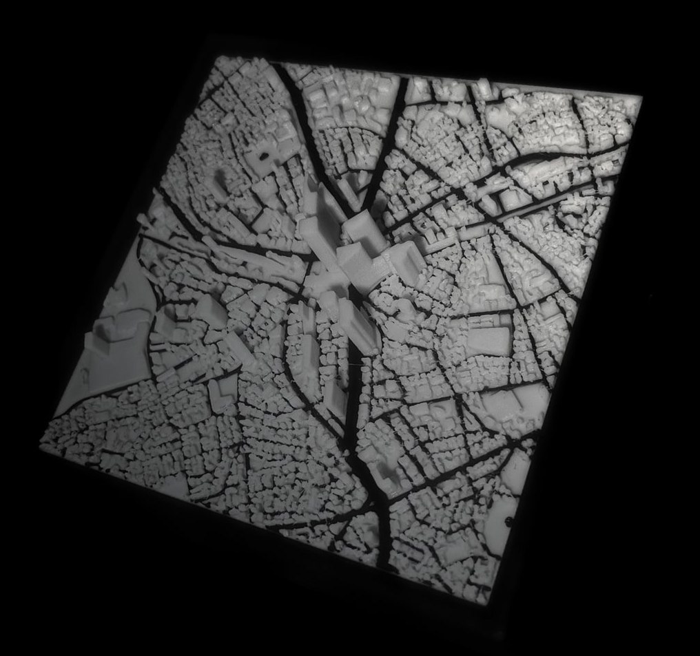
PLA, printed in two colours: structure in one filament, roads, parks and water inlaid in a contrasting one. Crisp edges, no paint, no stickers — the detail is the geometry itself.
Where does the map data come from?
Building footprints, roads, parks and water come from OpenStreetMap and Overture Maps; the ground relief is sampled from real elevation data. If the place exists on the map, we can print it.
How long until it arrives?
Production takes 2–4 business days. US standard shipping is 5–10 business days (express 2–4), Canada 7–14, international 10–21. Shipping cost scales with the size of the build.
Can I mount it on a wall?
Yes — every tile has blind M3 screw pockets hidden under the base (four on squares and circles, six on hexagons), so it mounts flush to a board or frame with standard M3 screws.
Can I preview exactly what I'll get?
The Studio renders the full 3D model in your browser before you order — every building, road and shoreline. What you see in the preview is the geometry we print.

Your city.
On your desk.

Open the Studio